Data-based solutions: Ternopil region presents regional geographic information system
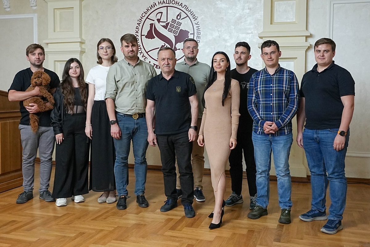
The Geographic Information System of the region (GIS), a large-scale digital tool that will help communities, analysts, managers and all stakeholders to take data-driven decisions, was officially presented in the Ternopil region. The system was developed entirely at the expense of the NGO ‘Ukrainian Researchers Society’, without attracting any budget or donor funding.
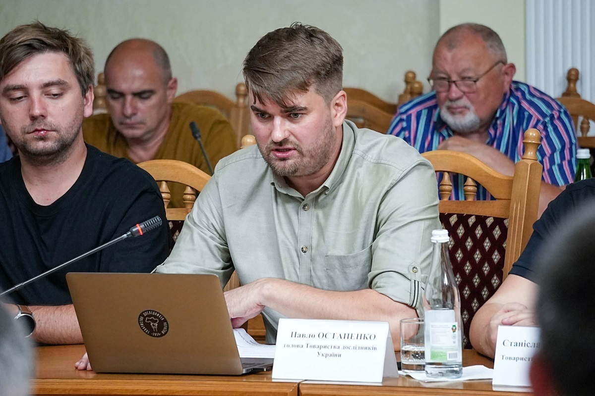
‘Civil society in Ukraine is more than just control or grants. We can develop tools on a par with the state. Our GIS is proof of that,’ said Pavlo Ostapenko, Head of the NGO ‘Ukrainian Researchers Society’ and project initiator.
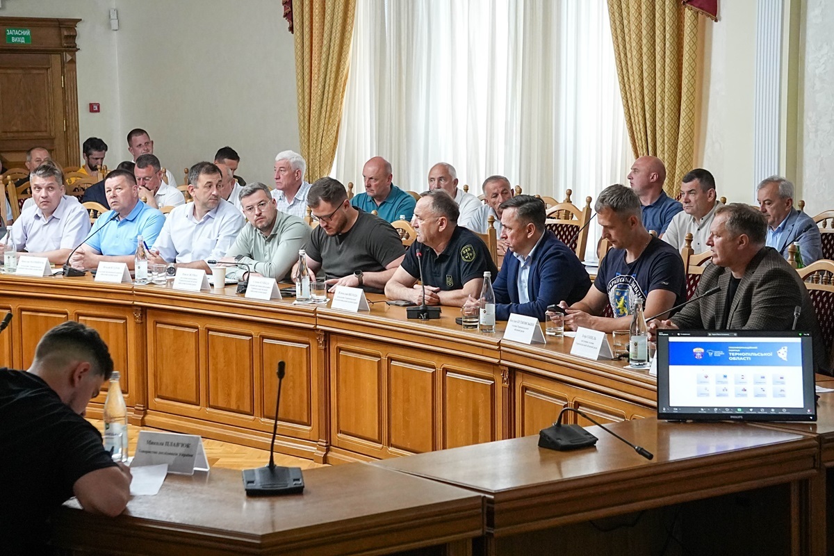
The event brought together community leaders from the Ternopil region, as well as representatives of territorial units of central executive authorities and structural units of the Regional Military Administration.
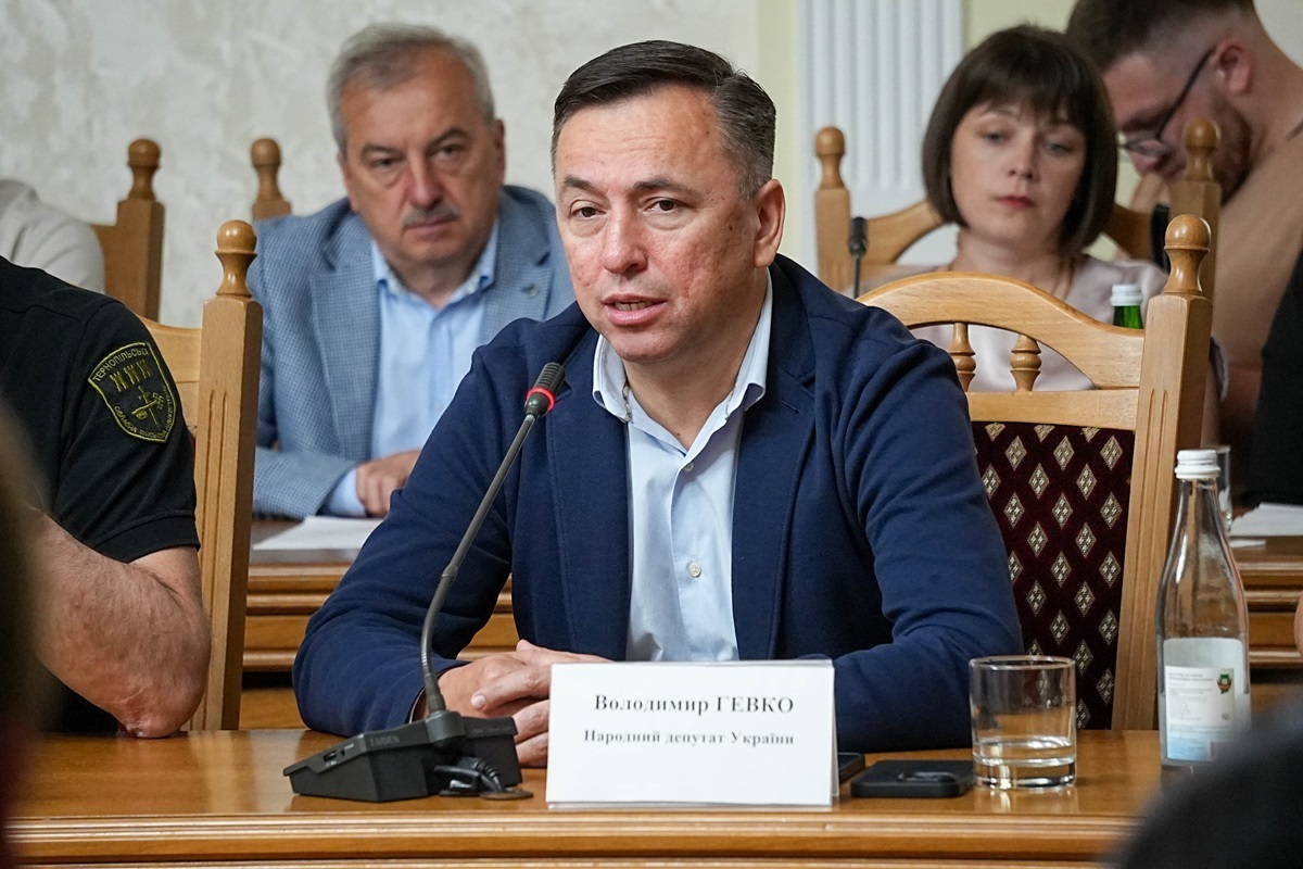
Volodymyr Hevko, Member of the Ukrainian Parliament, described the presented GIS of the Ternopil region as part of a key territorial management transformation, in which the Ternopil region is steadily gaining momentum.
‘The Ternopil region is confirming its status as a digital leader. It was not the first to start, but it is one of the first in terms of depth and scale. GIS is about a new management culture where decisions are based on accurate analytics rather than being made at a glance,’ said MP Volodymyr Hevko.
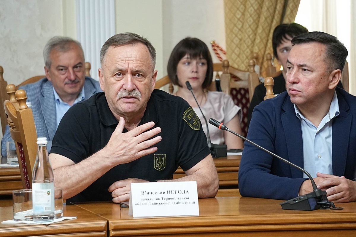
Viacheslav Nehoda, Head of the Ternopil Regional Military Administration, emphasised the strategic importance of GIS in managing regional development.
‘This tool is about a new quality of regional development, based not on intuition, but on accurate, open and structured knowledge. This is how a strategic vision is formed, and it is this approach that we support in the Ternopil region. It is about quality planning, transparency, and trust. It is about forming a vision for the region’s development based on analytics rather than intuition. The Ternopil region has set itself an ambitious goal: to be one of the leaders in terms of not only spirit and resilience, but also systemic accuracy, and analytical maturity. GIS is our step in this direction,’ said Viacheslav Nehoda, Head of the Ternopil Regional Military Administration.
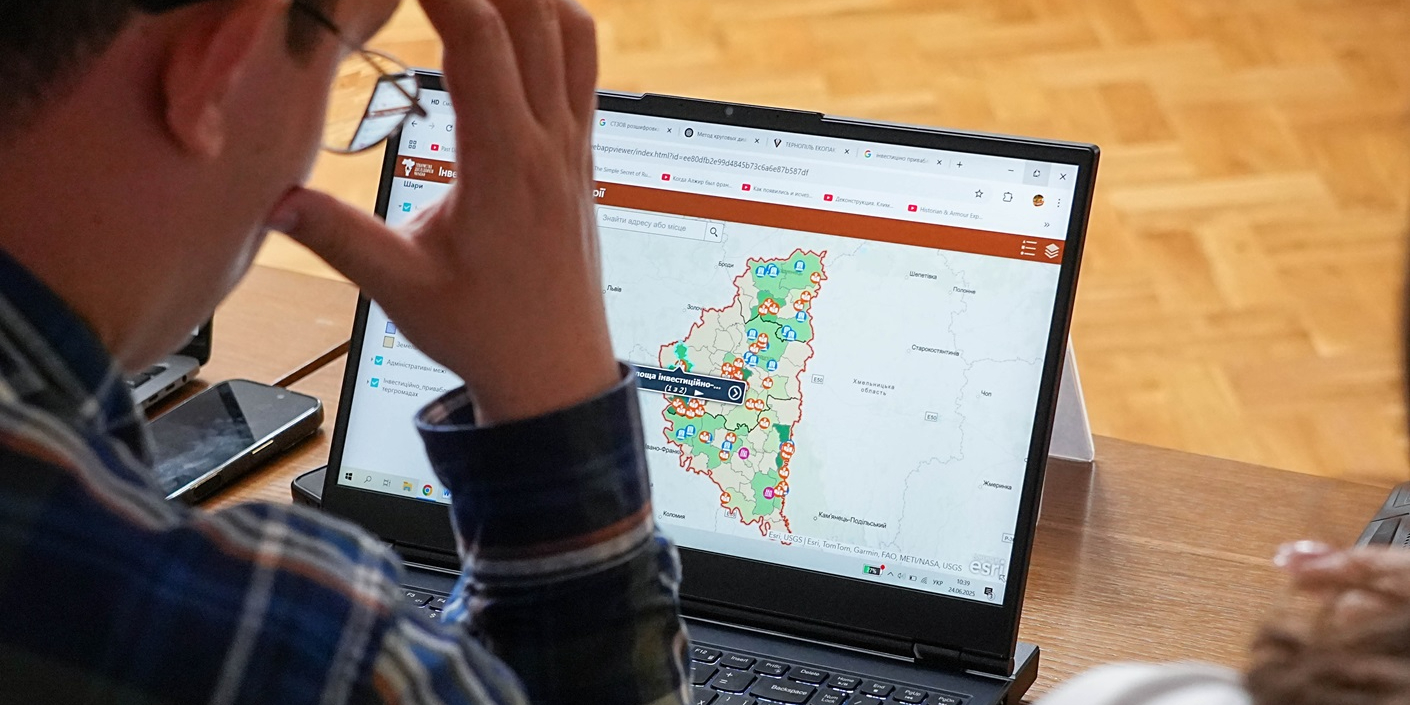
GIS of the Ternopil region contains:
- 510 geospatial data layers
- 1,150,887 polygonal objects
- 84,600 spot objects
- 10 thematic sections
- 43 electronic maps
- 200 indicators
The numbers speak for themselves: this is one of the largest regional GIS in Ukraine.
Further work will focus on creating a culture of data use among local governments, educational institutions, businesses and civil society. The next step is therefore to provide training in data management for local governments and other stakeholders, covering the effective use of GIS, its integration into management processes, and making fact-based decisions.
‘Our task is not only to create the system, but also to ensure it becomes a standard management practice in the region. We will also constantly update the data in the system, so similar meetings will be held in the region every year,’ said Pavlo Ostapenko.
Community opinion
Oleh Kokhman, Head of the Velyki Haii community, emphasised that the new system enables a comprehensive view of the territory, encompassing every site, problem, and perspective.
‘Decisions in communities have always been made responsibly. But now we have a tool that gives us the ability to think a few steps ahead. GIS combines managerial experience with data, enabling us to plan development as a system, not just individual objects. This represents a new level of management at a local level,’ commented Oleh Kokhman.
Bohdan Kelichavyi, Head of the Kopychyntsi community, acknowledges the importance of GIS as a technical solution and a platform for communicating with citizens and investors.
‘We have talked a lot about transparency, openness and encouraging people to engage with the development of the community. Now, we have a tool that enables us to do just that. GIS encompasses every object, project, and initiative. This is the community’s digital facade. It is useful for both partners and residents,’ said Bohdan Kelichavyi.
In September 2024, the Ternopil Regional Military Administration and the NGO ‘Ukrainian Researchers Society’ signed a Memorandum of Cooperation with the aim of creating a geographic information portal for the region. This project arose from the expertise of the NGO and the openness of the Ternopil Regional Military Administration to new approaches.

Attached images:
Tags:
elektronne vriaduvannia V.Nehoda Pavlo Ostapenko
Область:
Тернопільська областьSource:
Decentralization portal
01 July 2025
Децентралізація: найважливіше за червень
Децентралізація: найважливіше за червень
На початку кожного місяця портал «Децентралізація» підбиває підсумки місяця, що минув. Ми розповідаємо про важливі...
30 June 2025
Реформа управління публічними інвестиціями: у Києві відбулась презентація для громад
Реформа управління публічними інвестиціями: у...
У Києві відбулась презентація для представників громад та ОВА Київщини, Житомирщини та Черкащини присвячена реформі...
30 June 2025
УКФ та UCORD розпочали приймати заявки на конкурс «Згуртованість через культуру»
УКФ та UCORD розпочали приймати заявки на...
Український культурний фонд розпочав приймати заявки на грантовий конкурс «Згуртованість через культуру». Кінцевий...
28 June 2025
У Дніпрі обговорили реформу управління публічними інвестиціями
У Дніпрі обговорили реформу управління...
27 червня у Дніпрі відбувся регіональний захід, присвячений впровадженню реформи управління публічними інвестиціями...