‘Every community can and should claim compensation for polluted or lost land and natural resources.’ Interview with Pavlo Ostapenko
Head of the SCO Ukrainian Researchers Society speaks about the comprehensive assessment of territories affected by hostilities, and how communities can benefit from it
By Dmytro Syniak
The war has brought huge losses to Ukraine, particularly in terms of its people, economy, and infrastructure. However, the loss of fertile land is not widely discussed. This includes not only land in occupied territories, but also land contaminated by shell remnants, mines, drones and shrapnel, and land littered with craters from explosions. For the fourth consecutive year, the SCO Ukrainian Researchers Society, led by Pavlo Ostapenko, has been conducting a thorough evaluation of areas affected by hostilities and developing digital tools to assess the extent of the damage in each community. We spoke to Mr Ostapenko about how communities can use the findings of his research to plan their future development and recovery.
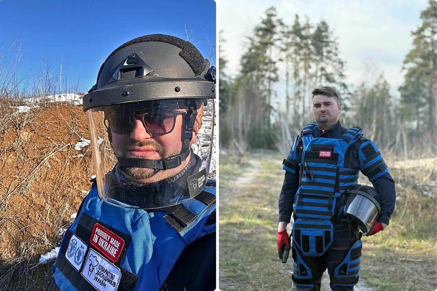
Pavlo Ostapenko, Head of SCO Ukrainian Researchers Society
Ukraine is an agrarian country. Soil is therefore the foundation of Ukraine’s economy. Losing this soil poses a serious threat to us and to our children’s future. So, how did the idea to conduct a comprehensive study of these territories come about? And what exactly does a comprehensive study entail?
Comprehensive assessment is a widely accepted research method in many fields, including economic geography and regional studies. We have been involved in this work since the beginning of the full-scale invasion. Initially, the focus was on assessing infrastructure, housing, utilities, and road damage. Following the liberation of Kyiv, Chernihiv, and Sumy regions in March–April 2022, which led to the enemy being pushed back from much of Ukraine, we conducted a comprehensive assessment of damage in four of the worst-affected liberated cities: Chernihiv, Sumy, Okhtyrka, and Trostianets. There were many organisations like ours, all working in essentially the same direction. But at a certain point, we realised that nobody was considering the broader picture: nobody was looking beyond localities to assess the full extent of environmental damage. Can you see what I mean? Not only the destruction of buildings, roads, bridges and other infrastructure in cities and villages, but everything in general. Currently, we are focusing on arable land because, for most communities, it forms the basis of the economy. People in villages rely on it for their livelihoods, and it provides us with food. Next, we will investigate the loss of forests, bodies of water, pastures and so on, until every piece of Ukrainian land has been assessed for the impact of hostilities.
What happened next?
Using the example of the Kyinka community near Chernihiv, our team developed a methodology for comprehensive assessment of losses, relying primarily on satellite imagery. Initially, we focused on arable land in general, including both populated areas (such as gardens, summer houses, and household plots) and areas outside of them. After that, we realised that this issue would be our main focus. After all, arable land is strategically important for our agricultural country. Ultimately, land encompasses not only fields, but also meadows, forests, rivers, and groundwater. All of these areas have been damaged as a result of the war. This is what a comprehensive view of such issues looks like.
Why is this important for communities? How should they interpret the findings of your research?
We have already conducted a thorough analysis of the situation in 99 communities across five regions of Ukraine. Overall, we plan to cover more than 200 communities. In my opinion, all de-occupied communities should conduct a comprehensive assessment of their losses. This assessment should underpin each community’s development strategy, recovery plan, and spatial development plan. In other words, we must understand what has been lost before we can rebuild. Ideally, the cost of these losses should be calculated and included in the reparations package that russia must pay. These losses should include not only housing, transport, roads, and energy infrastructure, but also fields, forests, and water surfaces. Putin said that russian territory extends wherever a russian soldier has set foot. Therefore, all occupying forces should be aware that every step on foreign soil will cost their state money in the future. For example, one step could cost one dollar, and one hundred steps could cost one hundred dollars. This will make occupying forces think twice about whether they really need to attack us and wage such senseless wars. On the other hand, every community, farmer and landowner affected by military action should be aware that they can claim these funds.
When it comes to soil contamination, mines and unexploded ordnance are usually the first things that come to mind. However, your maps even consider craters from explosions to be contamination. Could you please tell us more about the parameters you use to record soil loss?
When cut open, soil looks like a sponge. If a 40-tonne military vehicle drives over it, the soil becomes deformed. This deformation can affect soil fertility. The soil also contains geochemical barriers, or horizons, which have the ability to retain various chemical elements, including heavy metals. This affects the chemical composition of the soil, the condition of the groundwater, and ultimately the composition of the plants that will grow there. If we consume these plants or their fruits, some of these chemical elements will remain in our bodies forever. I am not trying to cause panic, but if we do not take this issue seriously, the health of our entire nation may deteriorate in the future.
What harmful substances are contained in the ammunition?
These are usually heavy metals found in explosives: arsenic (As), cadmium (Cd), chromium (Cr), copper (Cu), lead (Pb), mercury (Hg), nickel (Ni), zinc (Zn), strontium (Sr), then mineral nitrogen, mobile phosphorus, exchangeable potassium, mobile sulphur, polycyclic aromatic hydrocarbons… The list is very long. I would like to explain how contamination occurs. It is not only caused by unexploded shells or rockets, which still pose a danger. It can also be caused by anti-tank or anti-personnel mines that have not detonated, and the russians mainly use mines without self-destruction mechanisms. When exposed to chemical corrosion, this mine contaminates a certain amount of soil with the materials it is made of. This is exactly what happened during World War I in France, Germany, and Belgium. Our methodology is based on the results of those studies.
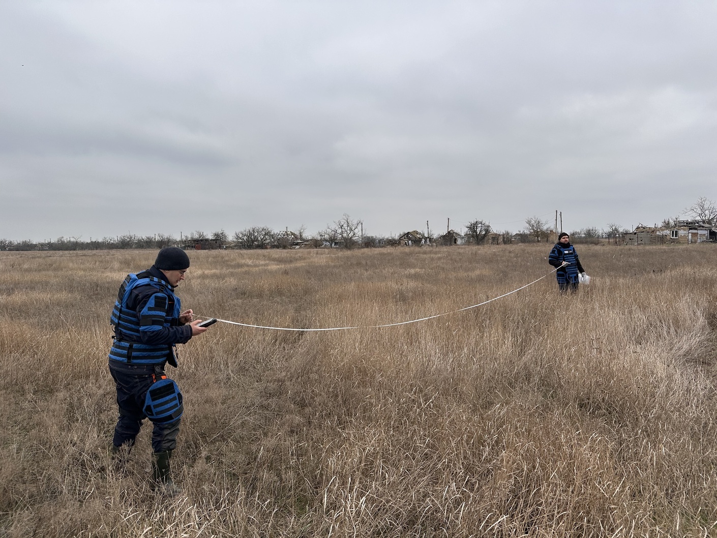
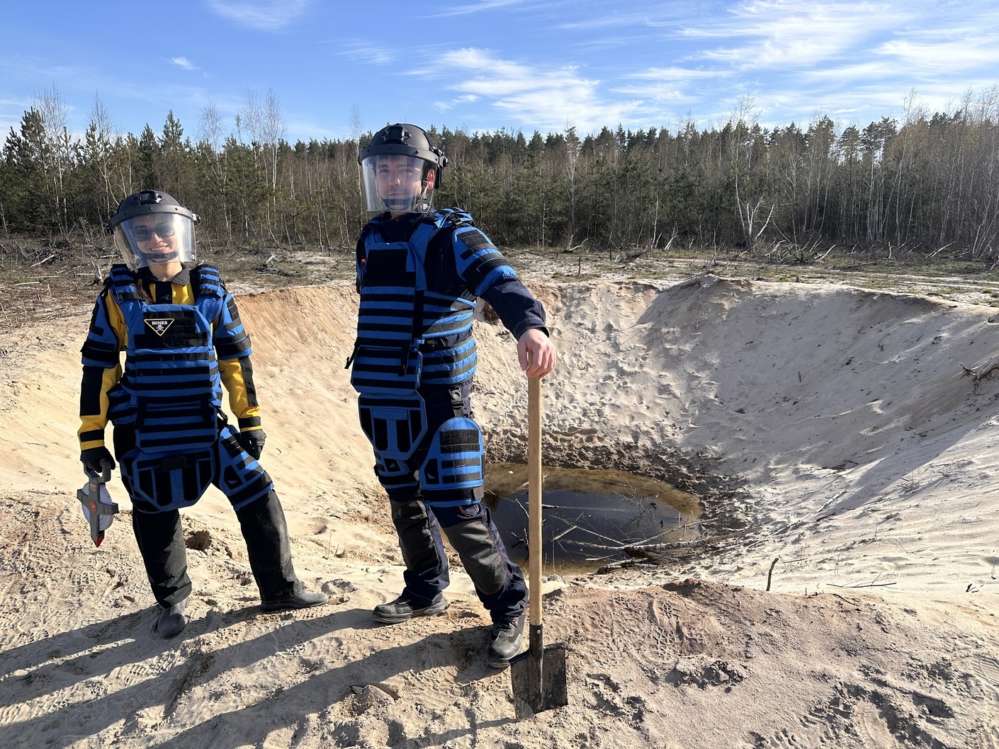
Work in Stepova Dolyna, Mykolaiv region
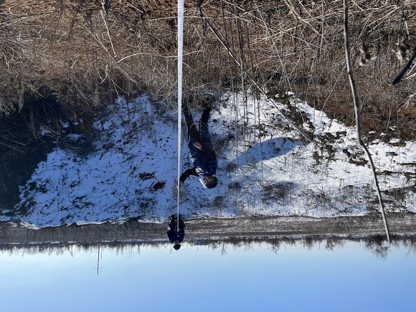
Measuring the size of the funnel near Snihurivka, Mykolaiv region
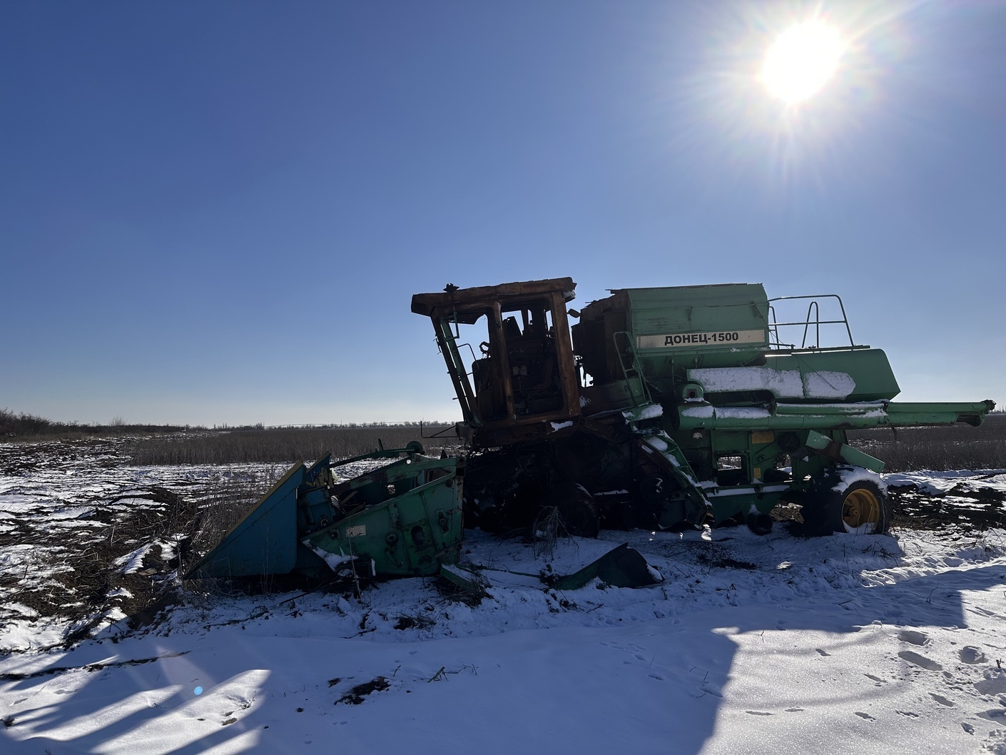
Agricultural vehicles destroyed by occupiers near Snihurivka, Mykolaiv region
In Babyntsi, Kyiv region
In the 2000s, there was a social advertising campaign against throwing used batteries in the bin. At that time, information was widely disseminated stating that one battery can pollute up to 10 cubic metres of soil. But how much does one mine pollute?
Well, it depends on the mine itself, the composition of the soil, and even the weather. For instance, podzolic soils, which cover much of Chernihiv and Sumy regions, as well as the northern parts of Zhytomyr and Kyiv regions, absorb pollutants relatively quickly. These substances enter the groundwater and eventually infiltrate and migrate with it to streams and small rivers, which then flow into larger rivers. We have calculated a total of 12 types of loss. We have evidence for all of these, based on the methodologies of various international organisations. You might be surprised to learn that NATO countries have specific environmental regulations governing the production of ammunition. This means that manufacturers must consider the potential for soil contamination caused by these munitions. If the level of pollution is too high, the ammunition may not be accepted for use. Military engineers then work on a different, cleaner composition of explosives, testing it at training grounds… Of course, our enemy takes a different approach and does not consider the environmental impact at all.
Ukraine is the largest country in Europe, so a thorough analysis of all the territories where hostilities took place is a huge task. What is the scope of your research? Are all regions included in your assessment?
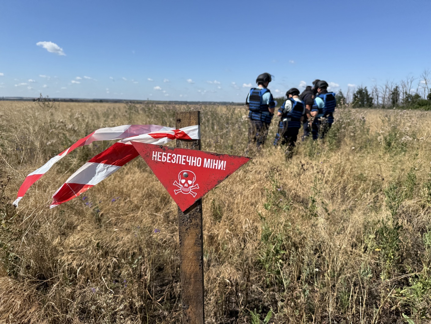
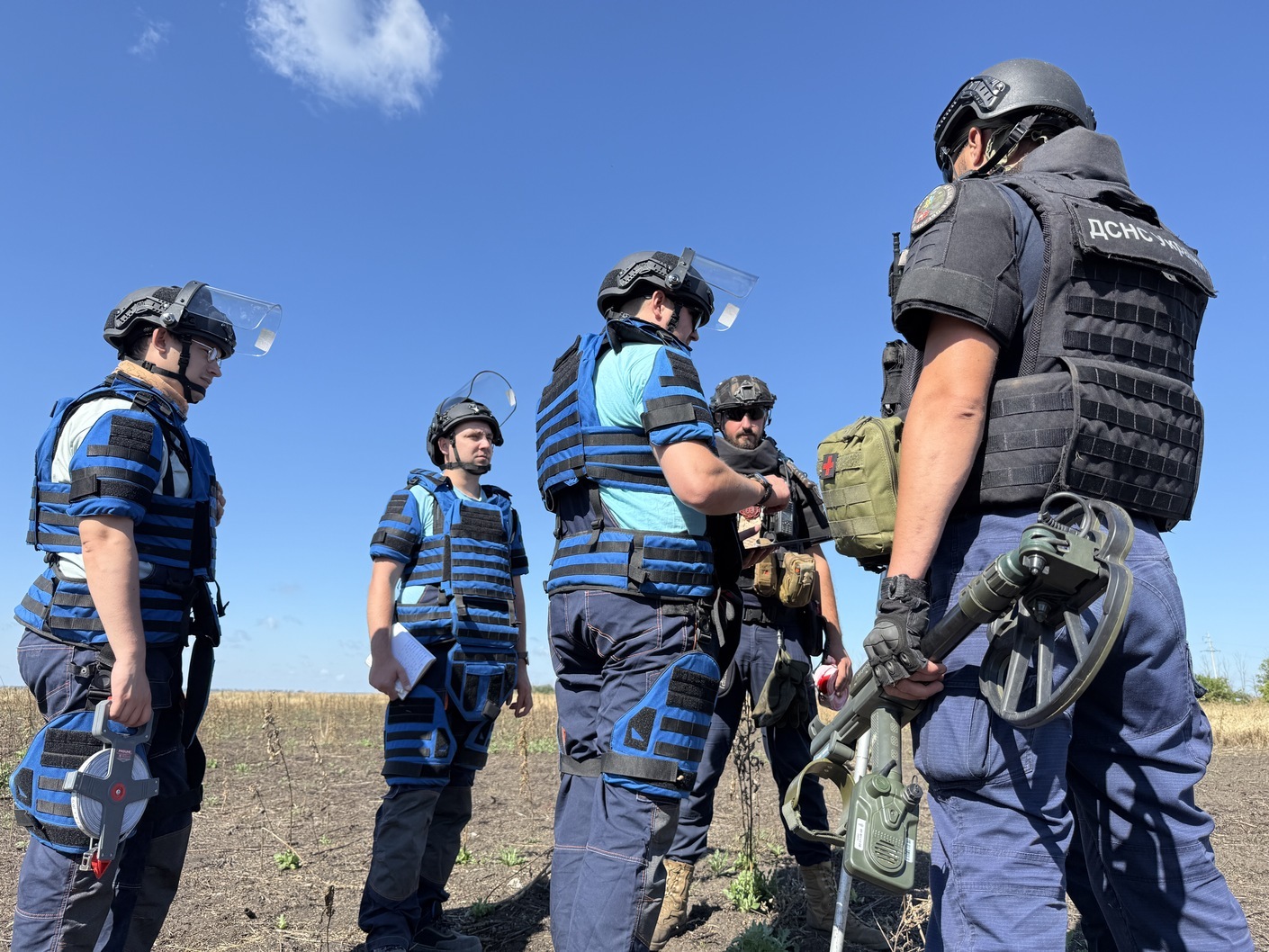
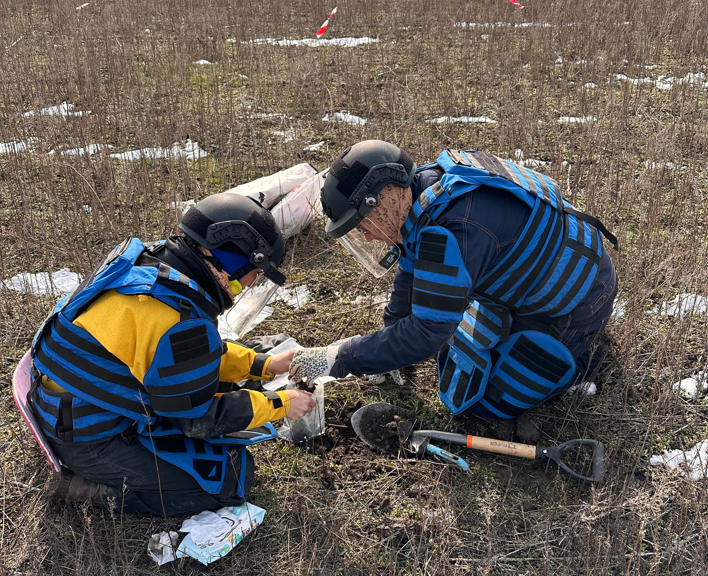
We certainly plan to investigate all regions affected by the hostilities. We have now finished researching five regions: Kharkiv, Mykolaiv, Kherson, Chernihiv, and Sumy. We are currently working in de-occupied areas of Zhytomyr, Kyiv, Dnipropetrovsk, and Zaporizhzhia regions. However, I should mention that we are only conducting research in areas where the likelihood of renewed hostilities is very low. We are also unable to work within 20 km of the front line, despite the fact that russian drones sometimes fly as close as 35 km. We are also at considerable risk because we are working in a minefield. In such areas, you have to look not only up to spot a drone in advance, but also down at your feet. So this is quite dangerous work.
What is the process of your work?
It consists of several stages. The first stage is remote assessment of the territory based on satellite images. This is followed by a stage of field checks. These are verification trips during which we check the location of craters in randomly selected fields, signs of cultivation and non-cultivation, the correctness of the geometry of agricultural plots, etc. We pay special attention to the selection of samples of affected soils. A separate team works on this, coordinating all actions, sampling methods, and then the laboratory analysis of these samples with the Food and Agriculture Organisation of the United Nations (FAO). We then describe all the results and create electronic maps. By the way, this year, the FAO published our report on Kharkiv region for the first time and posted it in its Knowledge Repository, highlighting our research methodology, which can be applied worldwide.
Do you cooperate with local farmers? How can they benefit from your research?
In fact, the ultimate beneficiary of each of our studies in every community is the Ukrainian citizen, whether they are a landowner or a property owner. Since communities own a lot of land, including agricultural land, they are also beneficiaries. After all, communities participate in our work too, for example by helping us communicate with farmers. We are eager to ensure that every farmer can claim compensation from russia for damages based on our research.
You provide some estimates of the damage in hryvnia. How do you get these figures?
They are approximate, or rather, minimal. That is, if you make a recultivation passport for each plot, the calculations will be more accurate and higher in hryvnia. Because such a passport includes not only an assessment of recultivation costs, but also an assessment of lost profits and many other aspects. In terms of overall figures, in Kharkiv region, within the territories that are not included in the 20-kilometre zone from the line of contact (which is almost 19,000 square kilometres, or about 40% of the territory of the region), we have calculated losses of UAH 36.7 billion. And this is not just a general figure based on some average values, areas, and general assumptions. For example, our analysis covered about 240,000 agricultural land plots (fields, household plots and summer cottages) that we identified manually. Thus, we calculated the losses for each plot or cadastral number individually. In doing so, we took into account not only direct losses, but also lost profits and environmental losses, as well as the amounts needed to restore the land. Across the five regions we studied, where we identified more than 800,000 agricultural plots of land, the total damage amounts to UAH 123 billion. This data is from the end of last year and is purely for arable land.
Does your research indicate any potential risks associated with the future use of these lands, such as chemical contamination or reduced soil fertility?
Yes, we do indicate such a risk. In fact, we have analysed almost 40,000 square kilometres in detail, identifying more than 800,000 agricultural plots (fields, household plots, summer cottage plots, and so on) as I have already said. Within these plots, we have identified over one million craters from explosions. We know their location and parameters. With this data, we can make predictions about the future use of the land. Although our margin of error is only 5%, our data is already reliable. Those who wish to do so can conduct more accurate research, for example, on geochemical composition, and then prepare a recultivation passport. However, such accurate research is quite costly. Our goal is to conduct such research globally and free of charge.
In Bairak, Kharkiv region
In Nova Husarivka, Kharkiv region
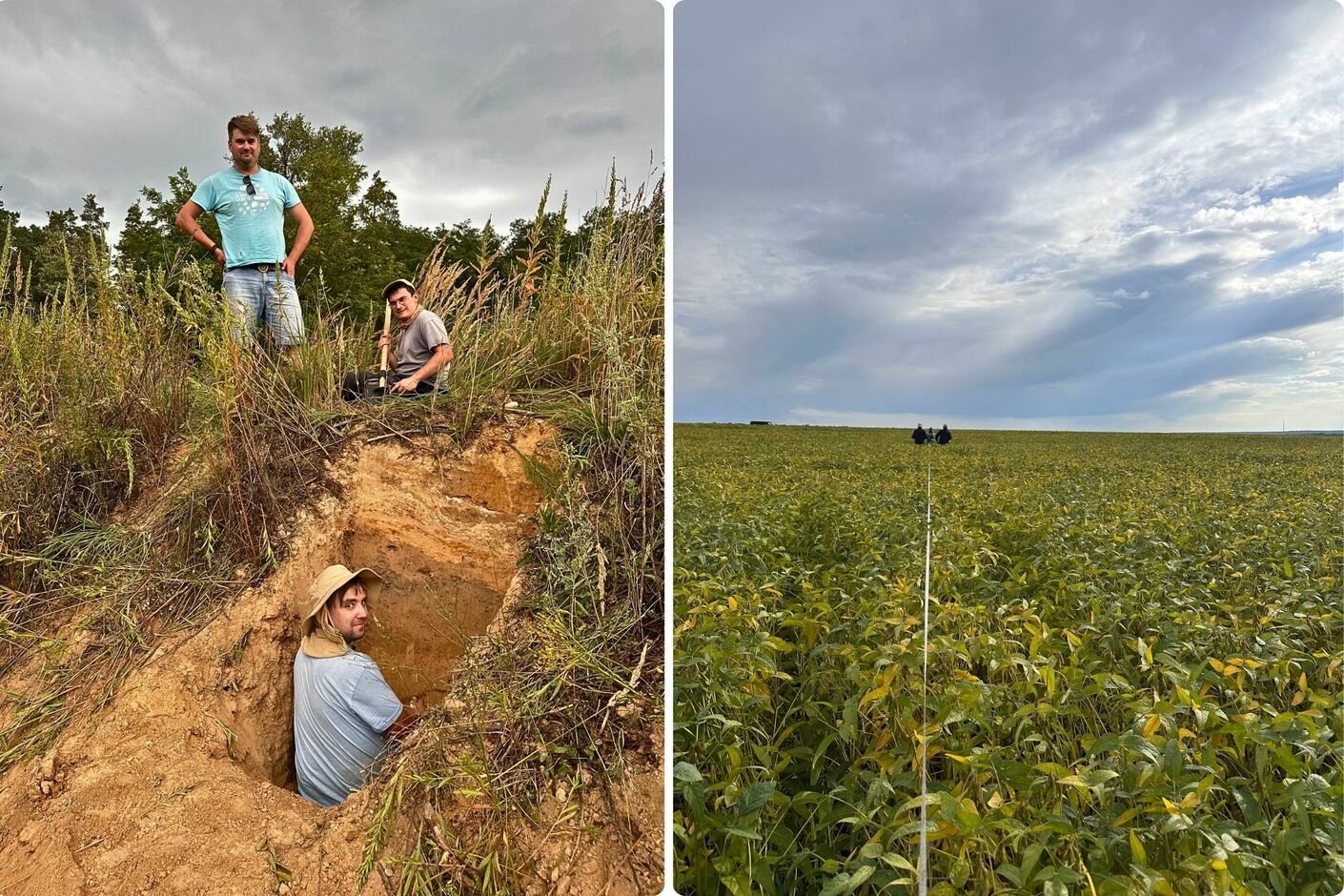
In Kyinka, Chernihiv region, which was used as an example by members of the Ukrainian Researchers Society to develop a comprehensive loss assessment methodology based primarily on satellite imagery (photo on the left). Taking measurements in Mashkove, Sumy region (photo on the right)
In Shevchenkove, Mykolaiv region
Who are the key partners in your project? Is the Ukrainian government involved? Are international organisations too?
When it comes to government agencies, we mostly work with the State Emergency Service. One reason for this is that some of our research is important for demining areas. The State Emergency Service already uses our data in a special IMSMA programme, which all demining participants use. This is the Ukrainian segment of the global IMSMA Core portal, created by the Geneva International Centre for Humanitarian Demining (GICHD). We also work with the Ministry of Economy, Environment and Agriculture of Ukraine, which is the direct beneficiary of our research. In addition, the results of our work are included in the Register of Potentially Contaminated Areas, which is currently being developed jointly by the State Emergency Service and the Humanitarian Demining Centre under the Cabinet of Ministers of Ukraine. Our data is also partially used by the Mine Action Centre of the Ministry of Defence of Ukraine. Moreover, we are in talks with the State Land Cadastre regarding the possibility of including our data in the cadastre as a separate layer. We also cooperate fruitfully with communities that are in our area of interest. I have not yet mentioned our cooperation with scientific institutions: the National Scientific Centre ‘O. N. Sokolovskyi Institute of Soil Science and Agrochemistry’ of the National Academy of Agrarian Sciences of Ukraine, the National University of Life and Environmental Sciences of Ukraine, Taras Shevchenko National University of Kyiv, and the Institute of Soil Protection of Ukraine. Our primary international partners are the Food and Agriculture Organisation of the United Nations (FAO), the United Nations Development Programme (UNDP) and the Government of the Swiss Confederation, the latter of which has supported some of our projects. Without the support of the FAO, our research would have been much more limited geographically. We are currently working to ensure that our joint methodology for researching agricultural land affected by hostilities can be applied in other countries.
Do you plan to expand your research, apply new methods, add new regions to your research portfolio?
We are currently working in four regions: Kyiv, Zhytomyr, Zaporizhzhia, and Dnipropetrovsk. Further expansion will depend on the conduct of hostilities and the movement of the front line. We will continue to collect and analyse soil samples in these regions and others that we have already researched. We will also carry out verification visits and trial new methods of remote assessment and soil sampling. The more we do this, the more accurate our research will become. Since we often work 20 km from the front line, we are improving these methods too. For instance, GPS often malfunctions in this area, and we constantly face dangers such as drones, mines, and shells.
How do you clean up areas affected by war? And how do you remove millions of kilograms of metal from the ground?
By the way, there are already some recultivation practices in place in Ukraine. However, these usually apply to soil that has been disturbed during industrial mining. Here, we are dealing with contamination from heavy metals and oxidising metal objects, which can alter the chemical composition of the soil. How can all this material be removed from the ground? One option is biological recultivation, which involves planting certain types of plants, such as clover, alfalfa, and burdock. These help to cleanse the soil. Of course, the hay from these plants cannot be fed to livestock and must be processed elsewhere, but that is another topic. For the most polluted areas, various microbial preparations can be used to improve and optimise the humus synthesis process, such as soil probiotics and certain organic substances. These include compost, organic fertilisers and even chicken manure. In general, recultivation scenarios are specific to each site. In our research, we have identified 14 typical scenarios.
Are shell and bomb craters also subject to recultivation?
Yes, they all need to be filled in. And that, by the way, is not always easy. Just imagine how much soil would be needed to fill in a crater measuring 12 metres in diameter and 4 metres deep! The largest crater I have seen was in Mykolaiv region. A direct missile strike caused a nitrate warehouse to explode. As a result, the crater reached 50 metres in diameter and 14 metres in depth. It would simply be too expensive to fill such a huge crater, as it would require about 40 train carriages of soil!
Where can communities read your research findings?
- On our website. However, there is one caveat: the maps are not publicly available. They contain sensitive information that we would not want to be distorted or misinterpreted. Therefore, we provide the maps on request via our email address: info@tdukr.com. This service is free of charge for communities, of course. It is our contribution to their development and recovery.
Scientific articles by members of the Ukrainian Researchers Society (SCO) in international journals with high citation indices, describing research methods and findings:
- War-induced soil disturbances in north-eastern Ukraine (Kharkiv region): Physical disturbances, soil contamination and land use change. Science of the Total Environment, 964, 178594. https://doi.org/10.1016/j.scitotenv.2025.178594
- Kharkiv Oblast’s changing landscape: A geospatial study of agricultural impact. 2021-2024. Rome, FAO. https://doi.org/10.4060/cd6502en
- Remote sensing as a key tool for assessing war-induced damage to soil cover in Ukraine (the case study of Kyinska territorial hromada). Journal of Geology, Geography and Geoecology, 32(3), 474–487. https://doi.org/https://doi.org/10.15421/112342
- From battlefields to blooming fields: The economic costs of restoring Ukraine’s war-damaged agricultural soil. Journal of Economic Issues, 59 (4), 1129–1134. https://doi.org/10.1080/00213624.2025.2575153
- Classification of war-induced soil contamination by the type of military impact in Eastern Ukraine. Land Degradation & Development, 1–27. https://doi.org/10.1002/ldr.70397
- Preliminary geochemical research of the military helicopter crash site in Kharkiv region. International Conference of Young Professionals “Geo-Terrace-2025”Geoterrace 2025-055. https://doi.org/10.3997/2214-4609.202552055
Tags:
13 January 2026
"Голова громади не повинен говорити з людьми...
Голова Градизької громади Полтавської області Мирослав Носа мало не щодня викладає у соцмережі ролики, які знімає та...
13 January 2026
Доходи місцевих бюджетів у 2025 році зросли на 14 %
Доходи місцевих бюджетів у 2025 році зросли на...
За даними Міністерства фінансів, у 2025 році загальний фонд місцевих бюджетів отримав 514 млрд грн – на 63 млрд грн...
13 January 2026
Вакансія Експерта/ки з підготовки та впровадження грантових проєктів
Вакансія Експерта/ки з підготовки та...
Вмієте писати грантові заявки, які приносять реальні результати? Проєкт “Відновлення для всіх” (RFA) шукає...
12 January 2026
Стартує прийом заявок на фінансування укриттів у ЗЗСО
Стартує прийом заявок на фінансування укриттів...
З 12 січня засновники закладів освіти можуть подавати заявки на отримання державної субвенції на облаштування...